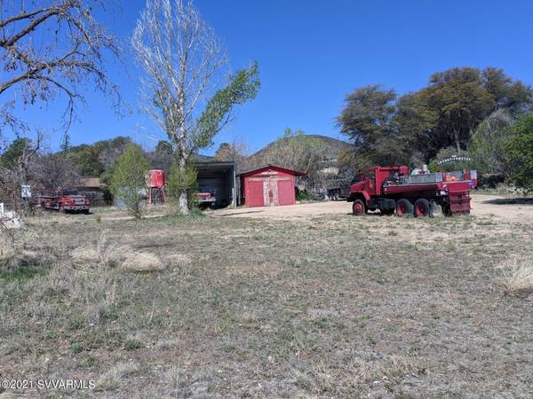
For more information regarding the value of a property, please contact us for a free consultation.
8.2-8.6 Mm W Cherry Creek Rd Rd Camp Verde, AZ 86322
Want to know what your home might be worth? Contact us for a FREE valuation!
Our team is ready to help you sell your home for the highest possible price ASAP
Key Details
Sold Price $105,000
Property Type Vacant Land
Sub Type Residential
Listing Status Sold
Purchase Type For Sale
Square Footage 899,949 sqft
Price per Sqft $0
Subdivision 5 Acres Or More
MLS Listing ID 526199
Sold Date 05/12/21
HOA Y/N false
Originating Board Sedona Verde Valley Association of REALTORS®
Annual Tax Amount $2,093
Lot Size 20.660 Acres
Acres 20.66
Property Description
Be King of your own mountain, with forever views..!! 20 acres of high country chaparral, pinion, oak, manzanita vegetation on this 20+ acre mining claim, surrounded by Prescott Nat'l Forest lands. Only 2+ miles from town of Cherry, or 3+ miles from Powell Springs campground. Build your retreat home, or possible for VrBO or AirBnb facility.
Cherry is a mining ghost town in Yavapai County, between Dewey and Camp Verde, located at an elevation of 5143 feet. Cherry's post office was established March 3, 1884 and discontinued March 15, 1943. Mines include the Federal, Bunker, Sunnybrook, Logan and Gold Bullion mines. About 400 people lived and worked in Cherry during its prime. At present, Cherry is mostly retirement & a vacation spot. A number of the original buildings are still in use.
Location
State AZ
County Yavapai
Community 5 Acres Or More
Direction SR Hwy 260, to Cherry Creek Road, past Yavapai County Justice facility, approx. 8 miles on Cherry Creek Road, between 8.2 mile marker and 8.6 mile marker. Or from SR Hwy 169, 8.2 miles, thru Cherry to Addie Road,, just past Addie on left @ one lane bridge. Signs are approx. @ both ends.
Building
Lot Description Many Trees, Views, Rock Outcropping, Borders Forest
Others
Pets Allowed Farm Animals, No
Tax ID 40303005g
Acceptable Financing Cash
Listing Terms Cash
Read Less
GET MORE INFORMATION


